The North-West Department of Education and Sport Development is one of the largest departments having staff complement of 30000 and serving 800000 learners annually.
The department have a need to respond to the needs of schools on the ground. This has resulted in a need for a department to require a solution that will follow a systematic approach of reporting and recording incidence and emergencies occurring at schools. The solution should enable real time incident recording and must have the ability to send alerts to the department’s officials, thus enabling the department to promptly respond to the needs of schools. This has triggered a need for the optimal implementation of the ArcGIS Platform to support these development initiatives.
The North-West Department of Education and Sport Development is a huge administration with diverse products and service offering especially to the schools. The biggest challenge that is faced by the department is the turnaround time on issues raised by any sector at any given time. The current method of disseminating information is primitive and non-effective because it’s still relying the most on paper methods.
The implementation of the platform should assist the operations within the department, but also establish standards that will ensure interoperability and integration of data, systems and other GIS resources.
Each school would require access to the solution through the principal or management of the school. The people assigned would be responsible to communicate incidents through the solution, this should give the department the best chance to respond with effective reaction times.
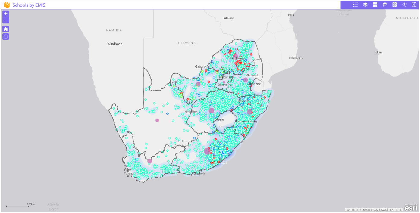
Spatial view of Schools with Incidents
The solution identified for these specific requirements was School Early Warning System. The Esri platform forms and integral part of the development of this system. The platform provides a spatial data infrastructure within the department. The ArcGIS Platform is an integrated web-GIS system that provides a wide range of capabilities for storing, managing, analysing, visualising and sharing geospatial data for all users within the organisation. The Platform provides the framework of data and technology needed to address a wide range of location-related business processes. Through change management processes, the department utilised ArcGIS Platform to introduce a method of reporting incidents at schools, backed up by photographic evidence.
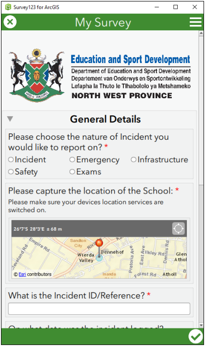
Integrated mobile component of the School Early Warning System
The implementation of the School Early Warning System through ArcGIS Platform, support the Programmes of the Department’s Strategic Plan Document, the Annual Performance Plan and Medium-Term Framework Plan which are in a form of Five Year Plan and are identified as indicators within the following Strategic Objectives:
- Ensure effective governance processes
- Improved functionality and performance of schools
- Enhanced accessibility of special schools
- Accessible quality Grade R Education
- Infrastructure management in schools and
- Examination services managed
As part of the solution, the incidents will be loaded and locked in a centralised server via mobile device (Survey 123) wherein a unique identifier will be allocated to the incident for tracking purposes.
The Department Official will acknowledge receipt of the incident to update its status to received or in progress, in an Operations Dashboard.
The school will have access to track the status of the incident logged via a Dashboard
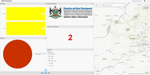
Dashboard to give an overall indication of incident status
By understanding the main objectives of the North-West Department of Education and Sport Development to support the various schools and functions, the optimal implementation of the ArcGIS Platform serves as the right solution to meet the challenges faced by Department.